
- TypeTraining or Development Class

- Location Nairobi, Kenya,Nairobi,Kenya

- Date 07-03-2022 - 11-03-2022
Education/Teaching/Training/Development
Research/Science
Business Development
Social Sciences
Administration/Management
Telecommunications
Information Technology
Agriculture/Agribusiness
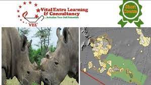
Course Title: Practical Training on Application of GIS and Remote Sensing in Wildlife and Conservancy Management
Duration: 5 Days
Location: Vital Extra Learning Center
Cost: USD 750
Course Description
Geographic Information Systems (GIS) play an important role in conservancy and wildlife management since the concerned resources are spatial in nature. Geographic Information Systems (GIS) involve collecting/capturing, storing, processing, manipulating, analyzing, managing, retrieving, and displaying geo-referenced data. Remote sensing is the acquisition of information about an object or phenomenon without making physical contact with the object. Wildlife management requires reliable and consistent information on the abundance and distribution of species as well as their habitats and threats. The application of remote sensing (RS) and geographic information system (GIS) in wildlife management and conservation aids in data collection and analysis of wildlife abundance, their distribution as well as providing data suitable for conservation planning and management.
Learning outcomes
By the end of this course the participants will be able to:
• Understand the principles of GIS and Remote Sensing
• Understand the concepts of wildlife management and conservation
• Describe and utilize spatial data, GIS, and remote sensing in conservancy and wildlife management.
• Competently carry out data capture, input, manipulation, and display by GIS
• Work competently with GPS/GNSS systems
• Understand the GIS database requirement and development for wildlife management and conservation
• Apply the GIS and Remote Sensing techniques in wildlife management and conservation
Who should enroll?
This course is ideal for professionals who require knowledge and skills on the use of GIS and RS in their organization in the field of conservancy and wildlife management.
Send an email to [email protected] to request a course training agenda
Why train with us
Vital Extra Learning guarantees our clients:
• State-of-the-art facilities and training infrastructure
• Extended tradition of hand-holding during post engagement
• Service delivery through highly seasoned industry experts.
• Value for money