GIS and Remote Sensing in Land Cover, Land Change Analysis Course

Posted By : User Ref No: WURUR56669 0
  • Image
  • TypeWorkshop
  • Image
  • Location Nairobi, Kenya
  • Price
  • Date 26-10-2020 - 30-10-2020
GIS and Remote Sensing in Land Cover, Land Change Analysis Course, Nairobi, Kenya
Workshop Title
GIS and Remote Sensing in Land Cover, Land Change Analysis Course
Event Type
Workshop
Workshop Date
26-10-2020 to 30-10-2020
Last Date for Applying
26-10-2020
Location
Nairobi, Kenya
Organization Name / Organize By
FineResults Research Services
Organizing/Related Departments
GIS and Remote Sensing
Organization Type
Company
WorkshopCategory
Non Technical
WorkshopLevel
All (State/Province/Region, National & International)
Related Industries

Information Technology

Computer/Technology

Location
Nairobi, Kenya

Dear all,

RE: GIS and Remote Sensing in Land Cover, Land Change Analysis Course

FineResults Research Services would like to invite you to high impact training GIS and Remote Sensing in Land Cover, Land Change Analysis Course to be held in Nairobi from 26th -30th  October, 2020.

                                           COURSE PROFILE

Course Name :GIS and Remote Sensing in Land Cover, Land Change Analysis Course

Venue: FineResults Research Training Centre, Nairobi, Kenya

Date: 26th -30th  October, 2020

Cost: USD 800

Registration: REGISTER HERE


INTRODUCTION

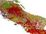
Land use and land cover change has become a central component in current strategies for managing natural resources and monitoring environmental changes. The advancement in the concept of vegetation mapping has greatly increased research on land use land cover change thus providing an accurate evaluation of the spread and health of the world’s forest, grassland, and agricultural resources has become an important priority. Viewing the Earth from space is now crucial to the understanding of the influence of man’s activities on his natural resource base over time. In situations of rapid and often unrecorded land use change, observations of the earth from space provide objective information of human utilization of the landscape. Over the past years, data from Earth sensing satellites has become vital in mapping the Earth’s features and infrastructures, managing natural resources and studying environmental change. Participants will therefore acquire hands-on skills in use of Geographic Information System (GIS) and Remote Sensing as a tool to capture, store, analyze, manage, and visualize land cover/use change and analysis.


DURATION

5 Days


COURSE OBJECTIVES

  • To introduce general and advanced GIS and Remote Sensing in land use/ cover changes.
  • To expose participants to Digital Image Processing with more emphasis on classification.
  • To demonstrate case study of a selected regions using remote sensing software.
  • To develop a sound basis for understanding the operation of GIS and Remote Sensing in Land use/cover change


COURSE OUTLINE

Module1:

Information

  • Introduction to GIS and Remote Sensing in land use/cover change
  • Land cover/use change concepts and frameworks
  • Drivers of land cover/use change
  • Classification System for the Mapping of Land Use and Land Cover
  • GIS project design and interpretation
  • GIS and Remote Sensing data used for land use/cover change
  • Understanding Sensor/Platform Systems for remote sensed data
  • Exercise I: Handling spatial information I :( Using Quantum GIS Software and SAGA GIS).


Module 2:

GIS data sources, data collection and integration techniques for DRM

  • Geo database Creation
  • Satellite image data sources for land use land cover.
  • Task I: GPS/mobile phone GPS for land use land cover data collection using Open Data Kit (ODK).
  • Activity: GPS/mobile Course Tour.
  • Exercise II: Handling spatial information II: GPS, GIS Integration using GIS/RS software.
  • GIS and RS for identification of extent of land use land cover
  • Land use and land cover mapping


Module 3:

Pre-processing land cover land use image

  • Radiometric and geometric image correction
  • Temporal normalization
  • Imagery Geo-coding and geo-referencing
  • Image enhancement
  • Thermal bands for use in land cover classification


Land use/cover classification

  • Signature development
  • Supervised Classification
  • Unsupervised Classification
  • Classification Accuracy assessment
  • Change detection
  • Determining Change in Specific Land Cover Types
  • Multi -criteria analysis for land use suitability site selection


Module 4:

Assessment of land use land cover

  • Assessment of spatial distribution of land resources
  • Monitoring of infrastructure
  • Monitoring dynamic changes in urban growth
  • Trend Analysis for Land use
  • Cluster analysis
  • Terrain analysis
  • Cost benefit analysis
  • Modeling and simulating land use


Module 5:

Online Publishing of maps and GIS output

  • Working with Google Maps and Fusion Tables
  • Publishing into other web based platforms


NB: We are offering you a half day, fun and interactive team building event!

ACCOMMODATION

Accommodation is arranged upon request. For reservations contact us through Mobile: +254 732 776 700 / +254 759 285 295 or Email: [email protected]


PAYMENT

Payment should be transferred to FineResults Research Services Limited bank before commencement of training. Send proof of payment through the email: [email protected]


Visit our website for more details


How to participate

Individual Registration


Contact information

Email:[email protected]

TEL: +254 732 776 700 / +254 759 285 295

Website: fineresultsresearch.org/training/

Visit our face book page

Visit our linkedin page  

Visit our twitter account


Registration Fees
Available
Registration Fees Details
USD 800
Registration Ways
Website
Address/Venue
  FineResults Research Services training center. Fahari Palace Apartments, along Church Road, Nairobi Kenya 
Contact
Training Coordinator

[email protected]

   +254 732 776 700
Customer Relations

[email protected]

   +254 759 285 295