
- TypeTraining or Development Class

- Location Mombasa, Kenya

- Date 04-09-2023 - 08-09-2023
Education/Teaching/Training/Development
Research/Science
Social Sciences
Computer/Technology
Hardware/Software/Networking Services
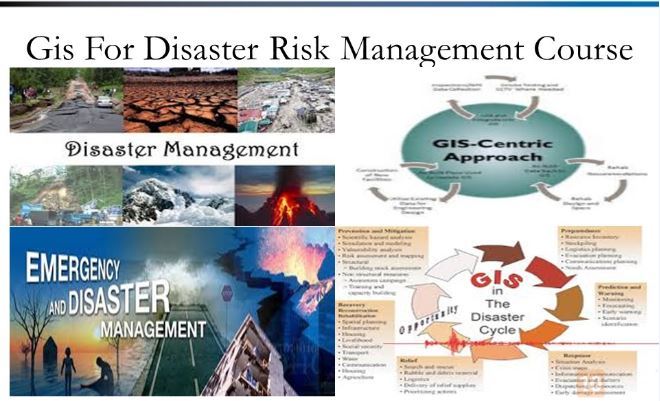
GIS APPLICATION IN DISASTER RISK REDUCTION TRAINING
Organizer: Skills for Africa Training Institute (https://skillsforafrica.org)
Registrations
https://skillsforafrica.org/course/67
Course Date
Location
06/03/2023-10/03/2023
Nairobi,Kenya
03/04/2023-07/04/2023
Nairobi,Kenya
01/05/2023-05/05/2023
Dubai,UAE
05/06/2023-09/06/2023
Mombasa,Kenya
03/07/2023-07/07/2023
Kigali, Rwanda
INTRODUCTION
Information and Communication Technologies (ICTs) have improved prospects for solving technical problems through the use of Geographical Information Systems (GIS) for hazard mapping and modeling, the use of web-based data sources to facilitate research on disaster management and the use of searchable databases for hazard information. Not all Caribbean countries, however, have been able to fully utilize these opportunities.
This course aims to impart practical skills on how to use GIS, to overcome the major challenges faced in all phases of disaster management.
COURSE OBJECTIVES
By the end of this course the participants will be able to:
· Describe and utilize spatial data
· Understand spatial data in the phases of pre disaster, during disaster and post disaster.
DURATION
5 Days
WHO SHOULD ATTEND
The training is intended for professionals working in development areas mostly in DRM related fields.
COURSE CONTENT
Disaster Management Concepts and Institutional Framework
· Basic GIS concepts and terminologies in disaster management.
· International and Regional Protocols and action plans relating to disaster risk management.
· Introduction to spatial information
Introduction to Geoinformatics, GIS data sources, and data collection
· Geographic Information System
· Data sources for DRM
· Data collection using Global Positioning Systems
· Data collection using Mobile Data Collection (ODK)
· Introducing GIS functions using QGIS
· Preparation of Earthquake Hazard Map
Hazard, Vulnerability and Risk assessment with QGIS
· Types and methods of risk assessment, risk evaluation, vulnerability analysis.
· Spatial data preparation and GIS integration techniques in Microsoft Excel
· Use of GIS in disaster preparedness planning.
· Elements at risk, hazard and vulnerability assessment using GIS.
· GIS Multi criteria analysis in vulnerability assessment.
Application of Risk Information for Risk Reduction Planning
· Visualization of risk information Using QGIS
· Risk mapping and database generation using QGIS
· Exercise: Creating a risk map
Applications of Geoinformation
· Disaster Scope, Examples & Advancements
· Introduction to Quantum GIS (open source)
Global and National Initiatives
· Overview of The Disaster Management Support Programme
· Key International and Regional Initiatives
· Disaster Management Planning and Emergency Response Case Studies
Public Participatory GIS and Disaster Risk Management
· Participatory GIS as a tool for DRM mapping.
· Use of Google Maps and Google Earth in DRM.
· Community crisis mapping.
GIS for Post Disaster Damage Assessment
· Flood inundation Mapping
· Preliminary Flood Damage Assessment
GENERAL NOTES
· This course is delivered by our seasoned trainers who have vast experience as expert professionals in the respective fields of practice. The course is taught through a mix of practical activities, theory, group works and case studies.
· Training manuals and additional reference materials are provided to the participants.
· Upon successful completion of this course, participants will be issued with a certificate.
· We can also do this as tailor-made course to meet organization-wide needs. Contact us to find out more: [email protected]
· The training will be conducted at SKILLS FOR AFRICA TRAINING INSTITUTE IN NAIROBI KENYA.
· The training fee covers tuition fees, training materials, lunch and training venue. Accommodation and airport transfer are arranged for our participants upon request.
· Payment should be sent to our bank account before start of training and proof of payment sent to: [email protected]