Organization Name / Organize By
Vital Extra Learning
Organizing/Related Departments
fineresultsresearch.org
Organization Type
Organization
WorkshopCategory
Both (Technical & Non Technical)
WorkshopLevel
All (State/Province/Region, National & International)
Related Industries
Education/Teaching/Training/Development
Research/Science
Business Development
Course title: Web-based GIS and Mapping
Dates and registration links:
06/02/2023 to 17/02/2023: http://bit.ly/3GtYhih
08/05/2023 to 19/05/2023: http://bit.ly/3XhebCQ
21/08/2023 to 01/09/2023: http://bit.ly/3hVg5sy
06/11/2023 to 17/11/2023: http://bit.ly/3TPytAi
INTRODUCTION
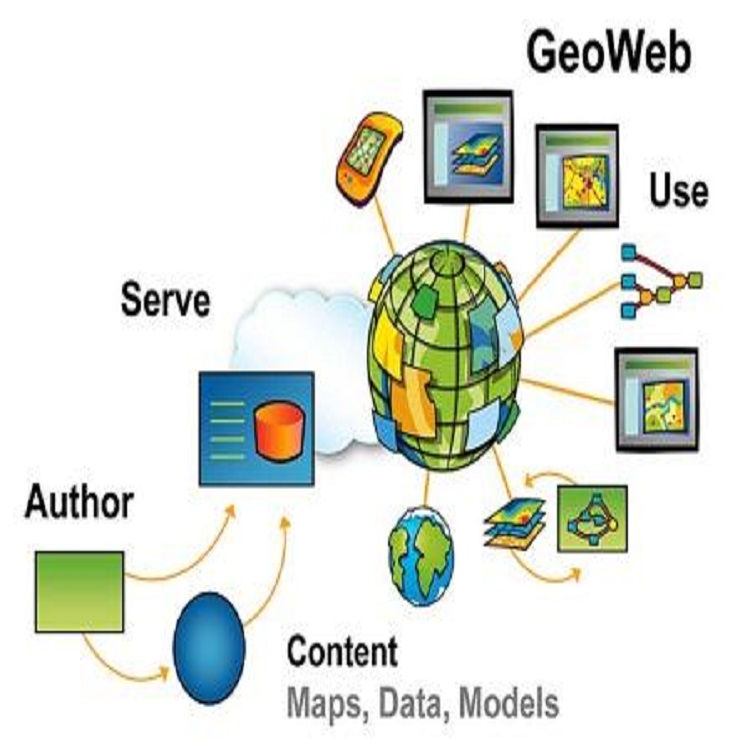
Web mapping focuses on disseminating and processing geographic information by means of Internet and World Wide Web. Combination of the web and GIS (Geographic Information Systems) has unlocked the potential of GIS, and put online maps and geospatial intelligence in the offices/homes of millions and the hands of billions. The increasing flexibility and interoperability of web mapping technologies has opened new opportunities for Web Based Mappers. Both non-GIS users and GIS experts can do more now, than ever to share maps over the internet. Web maps can easily deliver up to date information, maps are generated automatically from databases, and they can display information in almost real-time. They don't need to be printed, mastered and distributed. Web GIS has immense applicability to e-government, e-business, e-science, and all aspects of daily life. Government employees can utilize Web GIS to improve public services delivery and boost collaboration across agencies. Regardless of the sector, businesses can use Web GIS to enhance their existing business models and create new ones. Researchers can find new solutions to meet the challenges of the new frontiers. Web GIS has great practical value to our world today and into the future.
DURATION
10 days
LEARNING OBJECTIVES
- To understand the importance of web services and to give you some experience making web maps with FOSS and open standards
- Acquire skills how to make different types of web map
- Understanding spatial databases
- Learn how to publish maps online using open source software (Carto DB, fusion Tables,
- Able to Read Data from various Data source
- Processing spatial data with FOSS
- Drawing and querying maps on the server using Web Map Service
- Putting layers together with a web mapping API
- Learn how to Explore open data, VGI, and crowdsourcing
COURSE OUTLINE
Module 1
Introduction to key concepts in Web mapping
- Introductions to principles and concepts of GIS and web mapping
- Understanding OGC web mapping Standards
- Web GIS development cycle
- Evolution and types of web mapping Technology
- Understanding Free and Open Source Software and its use in web mapping
- Exploring QGIS as an open source software
- Find and share web maps on CartoDB
Module 2
Web Mapping Technologies
- Understanding spatial databases
- Tiled web map
- WMS service
- HTML
- XML/XHTM
- CSS
- Java script
- Write a page using HTML and CSS
Module 3
Designing web services and web maps using free open source software
- System architecture for web mapping
- Elements of a web map
- Analytic web maps
- Animated and real time
- Collaborative web maps
- Static web maps
Module 4
Reading Data from various Data source
- Converting shapefiles to XML
- Reading Points from an XML file
- Adding Side bars
- KML
- Using Fusion Table as Data source
- Ajax
- Reading shapefiles using javascript libraries
- Mapping your own data
Module 5
Processing spatial data with Free Open Source Software
- Understanding data formats for use in web mapping
- Processing spatial data with Free Open source Software
- geo-processing and projecting vector data with QGIS and OGR
- Processing raster data set with QGIS and GDAL
Module 6
Drawing and querying maps on the server using Web Map Service
- Dynamically drawn map services
- Introduction to basics of Open specifications for web map services and WMS specification
- Basic and advanced styling and symbolization with a WMS
Module 7
Building tiled maps with Free Open Source Software
- Introduction to Concepts of tiled maps
- Making the decision to build and maintain tiles
- Strategies for creating and serving map tiles
- Creating tiles with GeoServer using GeoWebCache
- Creating tiles with Mapnik using TileMill
Module 8
Putting layers together with a web mapping API
- Introduction to web mapping API
- Programming patterns with web mapping APIs
- Examining OpenLayers examples
- Overlaying a WMS on a tiled map with OpenLayers
Google Maps API
- Introduction to google maps
- Creating Custom Web maps without programming
- Orientation to Google maps API
- Adding Makers to Google maps
Module 9
Web based data editing
- drawing vector layers on the client side
- Working with vector KML
- Working with GeoJSON
- OpenStreetMap and its application in open data
- Downloading source data from OpenStreetMap
Module 10
Publishing maps using open source softwares (Geoserver)
- Overview Geoserver
- Installing and configuring Geoserver
- Publishing maps in Geoserver
- Data querying in Geoserver
Registration Fees
Available
Registration Fees Details
USD 1.600
Registration Ways
Email
Phone
Website