
- TypeTraining or Development Class

- Location Rwanda, Kigali, Rwanda

- Date 13-05-2024 - 17-05-2024
Education/Teaching/Training/Development
Research/Science
Business Development
Social Sciences
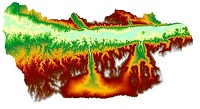
GIS have become essential tools for planning, resource management and decision-making. The ability of Geographical Information Systems tools to store, retrieve, analyze, model and map spatial data has enhanced its application. Geographic information systems are used in infrastructure management, project beneficiary mapping, service facilities mapping, land use planning, market analysis, impact analysis and utilities management. Among GIS tools, ArcGIS is one of the most used GIS software worldwide, the most stable and versatile recommended by most users. ArcGIS combines the science of geography with powerful GIS technology and provides contextual tools for data visualization, mapping and spatial analysis, connecting and combining information from varied sources, offering complex capabilities in order to explore and gain knowledge, that will lead to informed decisions in the different research fields. This training course on Spatial Data Analysis and GIS Mapping using ArcGIS will equip the participants with insights, knowledge and skills on how to use GIS tools to visualize real world features, explore spatial data and analyze maps to explore data in new ways and gain deeper understanding enabling information flow and appropriate decision-making.
Target Participants
This course is ideal for cartographers, GIS users, IT professionals, web developers, geoscientists, surveyors, software engineers, database and system administrators, and monitoring and evaluation experts.
Course Duration
5 Days
What you will learn
By the end of this course the participants will be able to:
Course Outline
Introduction to GIS Concepts
Introduction to ArcGIS
The Role of Data in ArcGIS
One Click Hotel 9 KN 37 St, Kigali, Rwanda
0777302410One Click Hotel 9 KN 37 St, Kigali, Rwanda
0777302410