
- TypeWorkshop

- Location Kigali, Rwanda

- Date 17-03-2025 - 21-03-2025
Education/Teaching/Training/Development
Research/Science
Agriculture/Agribusiness
Food Processing
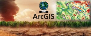
About the Course
Agricultural and climate change intervention projects and programmes may fail to achieve the required outcomes and impacts due to non-use of GIS and remote sensing technology. A geographical information system (GIS) is a collection of hardware software, and procedures to collect, manage, retrieve, manipulate, analyze and display spatial data. Remote sensing is the acquisition of information about an object or phenomenon without making physical contact with the object and thus in contrast to on-site observation, especially the Earth. This training workshop on Mapping/Visualization of Agriculture & Climate Change using ArcGIS will equip participants with handy skills for use in spatial and Earth Observation (EO) as a tool to integrate knowledge about climate change, agriculture, and food security in a meaningful and innovative way.
Target Participants
This course is useful for agricultural professionals who are involved in development in rural intervention and climate change programming. The course is useful for professionals who use spatial data as part of their work and who need to make decisions from such data.
What you will learn
By the end of the course the learner should be able to:
Course duration
5 days
Course Outline
Module 1: Introduction
Fundamentals of Monitoring and Evaluation
Data Collection Tools and Techniques
Introduction to spatial data gathering and analysis in agriculture and climate change
Introduction to GPS, GIS and Remote Sensing Principles
Data Acquisition in agriculture and climate change: Using Mobile based GPS (ODK)
Module 2: Data Acquisition and Database Design and Development
Data Acquisition in agriculture and climate change: Extraction of feature from other sources
Database Design and development for agriculture and climate change programming
Module 3: Editing and management of GIS and Integrating Imagery and Remote Sensing into GIS
Editing and management of GIS in agriculture and climate change
Integrating Imagery and Remote Sensing into GIS in agriculture and climate change
Module 4: Geo-Spatial Analysis and Introduction to cartographic visualization and the mapping process
Geo-Spatial Analysis in agriculture and climate change
Introduction to cartographic visualization and the mapping process in agriculture and climate change
Module 5: Online publishing of maps and GIS outputs
Online Publishing of agriculture and climate change maps and GIS outputs
Case study
Training Approach
This course is delivered by our seasoned trainers who have vast experience as expert professionals in the respective fields of practice. The course is taught through a mix of practical activities, theory, group works and case studies.
Training manuals and additional reference materials are provided to the participants.
Certification
Upon successful completion of this course, participants will be issued with a certificate.
Tailor-Made Course on Mapping/Visualization of Agriculture & Climate Change using ArcGIS
We can also do this as a tailor-made course to meet organization-wide needs. Contact us to find out more [email protected]
Payment
The training fee covers tuition fees, learning materials, and training venue. Accommodation and airport transfer are arranged for our participants upon request.
Payment should be sent to our bank account before start of training and proof of payment sent to [email protected]
| SI NO | Filename | Download |
|---|---|---|
| 1 | Document | Download |