Organization Name / Organize By
fineresults
Organizing/Related Departments
Training
Organization Type
Company
WorkshopCategory
Both (Technical & Non Technical)
WorkshopLevel
All (State/Province/Region, National & International)
Related Industries
Education/Teaching/Training/Development
Social Sciences
Computer/Technology
INTRODUCTION
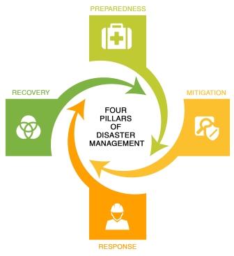
Disaster risk information is spatial in nature and Geographic Information Systems (GIS) play an important role in disaster risk management. Rapid population growth and urbanization combined with extreme climatic events are causing a rapid increase in vulnerability of communities exposed to hazardous events. Natural disasters inflict severe damage on almost the entire spectrum of social and natural habitats, ranging from housing and shelter, water, food, health, sanitation, and waste management to information and communication networks, supply of power and energy, and transportation infrastructure. There is a great need to utilize disaster risk information in planning for effective coping mechanisms of disaster risk reduction. For this, there is a significant need to create awareness among the disaster management professionals regarding the importance of GIS and Remote Sensing. This course is job oriented and aims to impact practical skills on how to use GIS and RS ,to overcome the major challenges faced in ,pre-disasters during disaster and post-disaster management such as during early warning, hazard, vulnerability and risk assessment, damage assessment, as well as in the design of risk reduction measures.
DURATION
5 Days
LEARNING OBJECTIVES
Upon completion of the course, the participants will be able to:
- Describe and utilize spatial data, GIS and remote sensing in disaster risk assessment and management
- Utilize existing sources of historical disaster information and elements at risk data
- Apply GIS/remote sensing in hazard, vulnerability and risk assessment
- Employ risk information in emergency preparedness planning
- Visualize hazard and risk information
- Apply GIS/remote sensing to post-disaster damage assessment
COURSE OUTLINE
Module 1:
Introduction
- Basic GIS and RS concepts and terminologies in the context of disaster management.
- International and Regional Guidance: Protocols and action plans
- Introduction to spatial information
- Exercise I: Handling spatial information I:(Using Quantum GIS Software).
GIS data sources, data collection and integration techniques for DRM
- Data sources for DRM.
- Satellite image data sources for DRM.
- Task I: GPS /mobile phone GPS for HV field GIS data collection using ODK.
- Activity: GPS/mobile Course Tour.
- Exercise II: Handling spatial information II: GPS, GIS Integration using QGIS.
- Group discussions: How can GIS and RS be used for identification of geographic areas affected by each natural hazard.
Module 2:
Hazard, vulnerability and Risk assessment with GIS and RS (Pre-Disaster)
- Types and methods of risk assessment, risk evaluation, cost-benefit analysis.
- Task II: Gentle Refresher of Microsoft Excel.
- Task III: Spatial data preparation and GIS integration techniques in Microsoft Excel
- Use of GIS in disaster preparedness planning.
- Task IV: Elements at risk, hazard and vulnerability assessment using GIS.
- Task V: GIS Multi criteria analysis in vulnerability assessment.
- Group discussion: How can GIS and RS be used to map existing buildings, infrastructure, land use and critical facilities located in potential hazard areas.
Module 3:
Application of Risk Information for Risk Reduction Planning (Pre-Disaster)
- Task VI: Visualization of risk information (Using QGIS/ILWIS/SAGA Software).
- Task VII: Risk mapping and database generation using Excel/QGIS and SAGA
- Task VIII: Disaster monitoring: satellite image processing techniques for change detection
- Exercise III: Creating a personal geodatabase for GIS emergency support manpower with personnel location information, contact information, and specialized skills.
- Exercise IV: Creating a risk map
- Group discussion: Use of GIS and RS in identification of the extent and magnitude of each hazard.
Module 4:
Introduction to Early warning systems and Information Networks (Pre-Disaster)
- Early warning systems and Information Networks for major hazards.
- Group discussion: How can GIS and RS be used in a Drought Early Warning System
Disaster Impact Analysis (Post Disaster)
- The use of satellite imagery for disaster relief and recovery.
- Activity: Visit to a satellite data receiving and processing station depending on location of training and availability of time.
- Group discussion: How can satellite images and aerial photos be used to locate refugee and internally displaced persons?
Module 5:
Public Participatory GIS and Disaster Risk Management (Pre and Post Disaster)
- Participatory GIS as a tool for DRM mapping.
- Task IX: Using Google Maps and Google Earth in DRM.
- Exercise VI: SMS to Map for community crisis mapping .
- Group discussion: What GIS and RS tools are suitable for mapping of urban (social) hazards such as crime zones, drug corners, and accident black spots
***************************
TRAINING CUSTOMIZATION
This training can also be customized for your institution upon request. You can also have it delivered your preferred location.
For further inquiries, please contact us through Mobile: +254 732 776 700 or Email: [email protected]
REQUIREMENTS
Participants should be reasonably proficient in English. During the trainings, participants should come with their own laptops.
TRAINING FEE
The course fee covers the course tuition, training materials, two break refreshments, lunch, and study visits.
ACCOMMODATION
Accommodation is arranged upon request. For reservations contact us through Mobile: +254732776700
or Email: [email protected]
Registration Fees
Available
Registration Fees Details
USD 800, KES 65,000
Registration Ways
Email
Phone
Website
Address/Venue
Fahari Palace Apartments, along Church Road, Nairobi Kenya
Fahari Palace Apartments, along Church Road, Nairobi Kenya