Organization Name / Organize By
Altum Training and Research Institute
Organizing/Related Departments
Altum Training and Research Institute
Organization Type
Organization
Training or Development ClassCategory
Both (Technical & Non Technical)
Training or Development ClassLevel
International
Related Industries
Education/Teaching/Training/Development
Research/Science
Business Development
Social Sciences
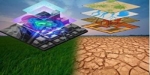
Remote Sensing and GIS technology is crucial in the acquisition of information about an object or phenomenon without making physical contact with the object. This training workshop will equip participants with hands-on skills for use in spatial and Earth Observation (EO) as a tool to integrate knowledge about agriculture and climate change. Participants will gain practical skills and knowledge needed to analyze, map, and monitor land surface features and weather physical properties spatially and temporally using GIS and Machine Learning technologies. In addition, analysis and understanding of the extracted information from satellite images, ranging from optical to SAR, will foster the applications of remote sensing in other fields related to agriculture and climate change such as food security, forestry, natural resources management, and many more.
Target Participants
The course is useful for professionals in the field of agriculture and climate change who use spatial data as part of their work and who need to make decisions from such data. Such professionals include M&E practitioners, agricultural projects and programmes managers, researchers, consultants and students, among others.
What you will learn
By the end of the course the learner should be able to:
- Appreciate the role of spatial data infrastructure (SDI) in agriculture and climate change setup
- Gain knowledge on how to acquire and process spatial data through optical and SAR satellite images
- Conduct agriculture and climate change modeling using GIS
- Collect data using Mobile data gathering tools
- Know how to analysis and understand SAR satellite data
- Integrate GIS within new and existing activities in agriculture and climate change.
Course duration
5 days
Course Outline
Module 1: Introduction to remote sensing and GIS technologies
- Characteristics of different optical and SAR satellite images.
- Properties of satellite images using GIS products.
- Monitoring climate change patterns using remote sensing and GIS technologies.
Module 2: Advanced analysis and processing of Satellite images
- Advanced and automated processing steps of both Optical and SAR satellite images.
- Collecting and processing of Unmanned Aerial Vehicle (UAV) imageries.
- Development of different Machine Learning models using satellite images and other geospatial data.
Module 3: Machine Learning for Land Use/Land Cover Classification
- Land Use/Land Cover classification and accuracy assessment using Machine Learning techniques (Unsupervised and supervised classifications)
- Change detection of different land surface features spatially and temporally.
- Incorporating different indices generated from Satellite images in Land Use/Land Cover classification to improve the accuracy and spatial representation of the classification output.
Module 4: Analysis and understanding of different SAR satellite data
- Basics theoretical and practical concepts on the SAR signatures from different satellite products.
- Applying the time-series SAR satellite images (Sentinel-1 and other SAR products with different bands) for monitoring of key concepts in agriculture and climate change.
- Processing and analyzing the SAR satellite images using Python and GIS products.
Module 5: Big Geo-data processing and storage
- General Big Geo-data tools and technologies.
- Storing, accessing, analyzing, and sharing Big Geo-data using popular techniques.
- Developing of machine learning workflows to handle and analyze Big Geo-data for supporting various decision-making processes.
Registration Fees
Available
Registration Fees Details
800 USD
Registration Ways
Email
Phone
Website
Address/Venue
One Click Hotel 9 KN 37 St, Kigali, Rwanda
One Click Hotel 9 KN 37 St, Kigali, Rwanda