GIS and Remote Sensing in Disaster Risk Management Course

6 years ago Posted By : User Ref No: WURUR19111 0
  • Image
  • TypeTraining or Development Class
  • Image
  • Location Westlands, Nairobi, Kenya
  • Price
  • Date 09-04-2018 - 13-04-2018
GIS and Remote Sensing in Disaster Risk Management Course, Westlands, Nairobi, Kenya
Training or Development Class Title
GIS and Remote Sensing in Disaster Risk Management Course
Event Type
Training or Development Class
Training or Development Class Date
09-04-2018 to 13-04-2018
Last Date for Applying
02-04-2018
Location
Westlands, Nairobi, Kenya
Organization Name / Organize By
Indepth Research Services
Organizing/Related Departments
GIS
Organization Type
Organization
Training or Development ClassCategory
Both (Technical & Non Technical)
Training or Development ClassLevel
International
Related Industries

Education/Teaching/Training/Development

OTHERS

Location
Westlands, Nairobi, Kenya

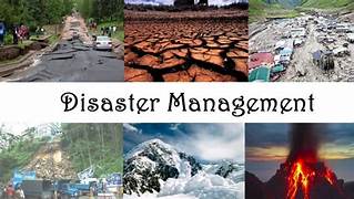
Event: GIS and Remote Sensing in Disaster Risk Management Course

Venue: Indepth Research Services, Nairobi, Kenya.

Event Date: 09nd April – 13th April 2018.

NITA CERTIFIED  

RECENT CLIENTS

INTRODUCTION

Disaster risk information is spatial in nature and Geographic Information Systems (GIS) play an important role in disaster risk management. Rapid population growth and urbanization combined with extreme climatic events are causing a rapid increase in vulnerability of communities exposed to hazardous events. Natural disasters inflict severe damage on almost the entire spectrum of social and natural habitats, ranging from housing and shelter, water, food, health, sanitation, and waste management to information and communication networks, supply of power and energy, and transportation infrastructure.

There is a great need to utilize disaster risk information in planning for effective coping mechanisms of disaster risk reduction. For this, there is a significant need to create awareness among the disaster management professionals regarding the importance of GIS and Remote Sensing.

This course is job oriented and aims to impact practical skills on how to use GIS and RS ,to overcome the major challenges faced in ,pre-disasters during disaster and post-disaster management such as during early warning, hazard, vulnerability and risk assessment, damage assessment, as well as in the design of risk reduction measures.

DURATION

5 Days

TARGETED AUDIENCE

The course is targeted at professionals who require knowledge and skills on the use of GIS and RS in their organization in the field of disaster management. Participants are welcome from a broad range of organizations including physical planning, institutions, professionals and private GIS and RS related firms.

LEARNING OBJECTIVES

Upon completion of the course, the participants will be able to:

  • Describe and utilize spatial data, GIS and remote sensing in disaster risk assessment and management
  • Utilize existing sources of historical disaster information and elements at risk data
  • Apply GIS/remote sensing in hazard, vulnerability and risk assessment
  • Employ risk information in emergency preparedness planning
  • Visualize hazard and risk information
  • Apply GIS/remote sensing to post-disaster damage assessment

TOPICS TO BE COVERED

  • Basic GIS and RS concepts and terminologies in the context of disaster management.
  • International and Regional Guidance: Protocols and action plans
  • GIS data sources, data collection and integration techniques for DRM
  • Hazard, vulnerability and Risk assessment with GIS and RS (Pre-Disaster)
  • Application of Risk Information for Risk Reduction Planning (Pre-Disaster)
  • Introduction to Early warning systems and Information Networks (Pre-Disaster)
  • Disaster Impact Analysis (Post Disaster)
  • Public Participatory GIS and Disaster Risk Management (Pre and Post Disaster)
  • Introduction to spatial information

Visit our website for more details

How to participate                                                                                               

  • Tailor Make a Course
  • Register as an Individual  
  • Register as a Group
  • Become One of Our Partners.
  • Purchase software’s
  • Frequently Asked Questions (FAQs)      

View related courses

  • GIS and Remote Sensing in Agriculture, Food Security and Climate Change Course
  • GIS and Remote Sensing in Disaster Risk Management Course
  • GIS and remote sensing in multi hazard early warning systems Course
  • GIS and Remote Sensing in Land Cover, Land Change Analysis Course
  • GIS and Remote Sensing in Mining and Exploration Course
  • GIS and Remote Sensing for agricultural resource management Course                      

The most popular courses

  • Integrated Soil Health and Fertility Management Course
  • Diseases Surveillance and Reporting Course
  • Data Management and Analysis for M&E in Development Programmes Course
  • M & E, Data Management & Analysis for Health Sector Programmes Course
  • Advanced Microsoft Excel Course
  • GIS Analysis for Health Sector Programmes Course
  • Participatory Rural development Action

View GIS and Earth Observation Institute Course Catalogue

For further inquiries, please contact us on Tel: +254 715 077 817, +254 (020) 211 3814, +254 731240802, +254 735331020.

ACCOMMODATION

Accommodation is arranged upon request. For reservations contact the Training Officer. Email: [email protected] Mob: +254 715 077 817 Tel: 020 211 3814

PAYMENT

Payment should be transferred to IRES account through bank on or before C.O.B. 02nd April 2018. Send proof of payment to [email protected]g


Others Details

ACCOMMODATION Accommodation is arranged upon request. For reservations contact the Training Officer. Email: [email protected] Mob: +254 715 077 817 Tel: 020 211 3814 PAYMENT Payment should be transferred to IRES account through bank on or before C.O.B. 02nd April 2018. Send proof of payment to [email protected]

Registration Fees
Available
Registration Fees Details
$1100
Registration Ways
Email
Phone
Website
Address/Venue
  Indepth Research Services  Pin/Zip Code : 00101
Official Email ID
Contact
Indepth Research Services

104289

[email protected]

   0715077817