GIS for Disaster Risk Reduction and Management Course

3 years ago Posted By : User Ref No: WURUR79185 0
  • Image
  • TypeTraining or Development Class
  • Image
  • Location Hargeisa, Somalia
  • Price
  • Date 28-06-2021 - 02-07-2021
GIS for Disaster Risk Reduction and Management Course, Hargeisa, Somalia
Training or Development Class Title
GIS for Disaster Risk Reduction and Management Course
Event Type
Training or Development Class
Training or Development Class Date
28-06-2021 to 02-07-2021
Location
Hargeisa, Somalia
Organization Name / Organize By
Upskill Development Institute
Organizing/Related Departments
Upskill Training Department
Organization Type
Education Institution
Training or Development ClassCategory
Both (Technical & Non Technical)
Training or Development ClassLevel
All (State/Province/Region, National & International)
Related Industries

Education/Teaching/Training/Development

Social Sciences

Location
Hargeisa, Somalia

CLICK ON THIS LINK to view course outline and register to attend

Organizer: Upskill Development Institute

INTRODUCTION

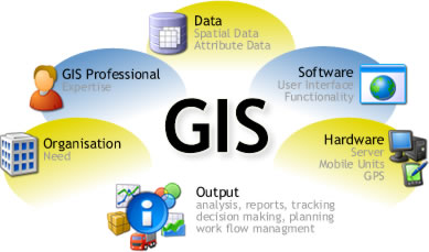
Information and Communication Technologies (ICTs) have improved prospects for solving technical problems through the use of Geographical Information Systems (GIS) for hazard mapping and modeling, the use of web-based data sources to facilitate research on disaster management and the use of searchable databases for hazard information. Not all Caribbean countries, however, have been able to fully utilize these opportunities.

This course aims to impart practical skills on how to use GIS, to overcome the major challenges faced in all phases of disaster management.

WHO IS THIS TRAINING INTENDED FOR?

The training is intended for professionals working in development areas mostly in DRM related fields.

DURATION

5 Days

TRAINING OBJECTIVE

Upon completion of the training, the participants will be able to describe and utilize spatial data through manipulating it in the phases of pre disaster, during disaster and post disaster.

TRAINING CONTENT

Disaster Management Concepts and Institutional Framework

  • Basic GIS concepts and terminologies in the context of disaster management.
  • International and Regional Protocols and action plans relating to disaster risk management.
  • Introduction to spatial information

Introduction to Geoinformatics, GIS data sources, and data collection

  • Geographic Information System
  • Data sources for DRM
  • Data collection using Global Positioning Systems
  • Data collection using Mobile Data Collection (ODK)
  • Introducing GIS functions using QGIS
  • Preparation of Earthquake Hazard Map

Hazard, Vulnerability and Risk assessment with QGIS

  • Types and methods of risk assessment, risk evaluation, vulnerability analysis.
  • Spatial data preparation and GIS integration techniques in Microsoft Excel
  • Use of GIS in disaster preparedness planning.
  • Elements at risk, hazard and vulnerability assessment using GIS.
  • GIS Multi criteria analysis in vulnerability assessment.
  • Group discussion: How can GIS and RS be used to map existing buildings, infrastructure, land use and critical facilities located in potential hazard areas.

Application of Risk Information for Risk Reduction Planning

  • Visualization of risk information Using QGIS
  • Risk mapping and database generation using QGIS
  • Exercise: Creating a risk map
  • Discussion: Use of GIS in the identification of the extent and magnitude of each hazard.

Applications of Geoinformation

  • Disaster Scope, Examples & Advancements
  • Introduction to Quantum GIS (open source)

Global and National Initiatives

  • Overview of The Disaster Management Support Programme
  • Key International and Regional Initiatives
  • Disaster Management Planning and Emergency Response Case Studies

Public Participatory GIS and Disaster Risk Management

  • Participatory GIS as a tool for DRM mapping.
  • Use of Google Maps and Google Earth in DRM.
  • Community crisis mapping Using Ushahidi.

GIS for Post Disaster Damage Assessment

  • Flood inundation Mapping
  • Preliminary Flood Damage Assessment

Training Approach

This course will be delivered by our skilled trainers who have vast knowledge and experience as expert professionals in the fields. The course is taught in English and through a mix of theory, practical activities, group discussion and case studies. Course manuals and additional training materials will be provided to the participants upon completion of the training.

Tailor-Made Course

This course can also be tailor-made to meet organization requirement. For further inquiries, please contact us on: Email: [email protected] Tel: +254 721 331 808

Registration Fees
Available
Registration Fees Details
Online training course fee: 600 usd and Classroom training course fee: 1000 usd
Registration Ways
Email
Phone
Website
Address/Venue
  Upskill Training Center 
Official Email ID
Contact
Danson Mwaniki

Upskill Training Center

[email protected]

   +254721331808