
- TypeTour

- Location Kullu, Himachal Pradesh, India

- Date 10-08-2019 - 20-08-2019
Region: Manali / Lahul Valley/Ladakh
Itinerary
Day 1 Arrival Base Camp Naggar (Manali).
Arrive Naggar where you would be greeted by our representative and transferred to our Camp site named “Nature Outpost Camps”. Naggar is an ancient village of Kullu District just before 18 KM of Manali. Today, we would spend the day in Naggar itself to acclimatize to the high altitude. This is absolutely necessary and is most important for the days ahead.
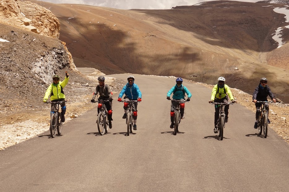
After settling down in the camp, we were all introduced to our most important allies for the journey- the cycles. Cycles would be handed over to Participants on the same day for Test Ride. We went for a 20 km practice ride to get a feel of the cycles and of the mountains. The slopes around Laran kelo are a bit steep and I was relieved when we were told that the slopes on the Manali-Leh highway are more gradual. That night, we sat together making small talk. We were all excited about the journey that we had long been preparing for. Overnight in the Luxury Camp.
Day 2 Manali-Marhi (11023 ft) 36 km
We were driven to Manali, cycles and all, early in the morning. From there we were to cycle about 36 km to Marhi- a continuous climb that took us from 6700 ft to 11000 ft. The ride, though strenuous, took us through some exquisite locations. The mountainside, which is thickly covered in vegetation- trees and shrubs alike, is a treat for any nature lover. As we climbed higher, human settlements became fewer and farther apart. The last one before Marhi, Gulaba, was about 20 km away. Marhi itself is just a cluster of dhabas and camping sites which acts as a comfortable stop over for road travellers. We camped at night under a clear sky where the stars were as clearly visible as the back of my hand.
Day 3 Marhi to Sissu 10235 ft via Rohtang La (13050 ft) 50 km
The 16 km climb to Rohtang La was more fun than hard work. We came across what looked like a slab of white rock but turned out to be a remnant of the snowfall of the previous winters. There’s a temple of Rishi Vyas which marks the origin of the Beas River slightly before Rohtang which is a popular stop over for tourists.
The first few kilometres of the climb down from Rohtang was both exhilarating and unsettling at the same time. Rohtang pass is an uphill area covered with snow at height of around 13052 feet above sea level, very chilling and pleasant atmosphere , our route will be starting from this point The speed is exhilarating but the steep falls on one side and the hairpin bends are sometimes unsettling. But all that is for the first few kilometres, after that the road vanishes and a kachcha track starts that doesn’t allow any great speeds. Continuous downward of around 17 kms from Rohtang pass till Sissu village. This continues up to Koksar from where the roads suddenly show up again and there’s a rolling terrain alongside the Chandra River up to Sissu.
Day 4 Sissu to Jispa (10480 ft) 53 km
We left Sissu after tea and breakfast consisting of porridge and one of the best pohas I’ve ever had. The ride, with towering mountains on one side and the serene flow of the river on the other, had a calming effect. A gradual route from sissu to around 8-10 km, where it gets climb for around 20 km or so later it stretches to jispa .
It is advisable to drink lots of water at high altitudes and you need not always depend on the support vehicle for refilling your bottles. The highway is frequently intersected by fresh water streams that are blissfully cool and refreshing. Keylong, which falls halfway between Sissu and Jispa, serves as an excellent place for having lunch- a meal that usually consisted of chapattis rolled with vegetables and a boiled egg and potato as accompaniments. It’s surprising how a simple boiled potato can be so delicious.
After Keylong, the mountainside starts dropping subtle hints that you are moving towards a desert. The vegetation becomes noticeably thinner and one gets the impression that brown and green are competing each other to become the dominant colour. One has to be careful as some of the more errant stones might come rolling down onto the road. After a few kilometres of uphill and a few more of rolling terrain, we reached Jispa. Located at the banks of Bhaga River, Jispa is as peaceful as a permanent human settlement can be. It has a monastery which boasts of Dalai Lama’s visit to it.
Day 5 Jispa-Zing Zing Bar (14000 ft) 60 km
We woke up in the morning to the sound of rain outside. All my research and talks with experienced people had told me that we could expect rains the first three days and after that the chances of the heavens opening up were very slim. And yet there was no mistaking the sound of a steady drizzle. We geared ourselves against the rains with wind cheaters and the likes and we were off, ready to face this new challenge.
With Jispa, we left behind some other things as well- settled civilisation, vegetation cover, and mobile signals. Route is a slight upward climb after jispa till 8-10 kms.
That day, apart from the rains, we also faced the challenge of climbing up on kaccha tracks, though it was not very long. We reached Deepak Taal a nice place to refresh in Patseo which had a board claiming that on a bright sunny day, the lake mirrors its surroundings. We, however, could not verify the claim as the day was cloudy. After Patseo, there is rolling terrain up to Zing Zing Bar. From there the climb to Baralacha La starts. Our camp was set up 6km ahead of ZZ Bar. Gradual increase in altitude and a bit start of altitude prone area, gradual slope till zing zing bar. We climbed steadily and reached the dhaba where we were to sleep that night in no time and were welcomed with a glass of hot soup.
At this time we were at a height of 14000 ft and it had started getting pretty cold. At night, as some played cards and others chatted, I sat reading by torchlight. It would have seemed like strange gathering to any outsider but we were all releasing our stress the best we could and gearing up for the climb the next day.
Day 6 ZZ Bar to Brandy Nallah via Baralacha La (15900 ft) 68 km
The 16km climb to Baralacha La was pretty gradual. What really slows one down is the low amount of oxygen (the simple task of bending to tie your shoelace can leave you breathless). We climbed at our own paces in twos or threes as it is never advisable to strain the body at such heights.
The desert had made itself evident now. The brown colour had won the battle and greenery was nonexistent for all practical purposes. One sees a new variety of vegetation- small red plants that looked like they were oddly coloured sand. Baralacha La, at the height of 15900 ft, is cold, made more so by the ceaseless winds. We climbed down after clicking a few pictures and had lunch at a dhaba which was located at the banks of a river. The serene flow of the river and the majestic mountains surrounding it had not ceased to amaze me, and they would not for the rest of the journey.
Post lunch, there was a stretch of rolling terrain up to Sarchu which marks the border between Himachal Pradesh and Jammu and Kashmir. There was no change in the surroundings, the mountains were as barren and as high as they had been earlier, there was not even a board welcoming us to J&K. But still, entering J&K made me feel as if I had suddenly come closer to my destination. It was a feeling that gave me a renewed energy. It was another 20 km to Brandy Nullah where we were to camp that night. It was a bitterly cold night and I was happy to get inside my sleeping bag after dinner.
Day 7 Brandy Nallah-Nakee La 15547 ft-Lachulung La (16616 ft- Pang 15100 ft) 56 km
This was perhaps the most difficult day with Gata Loops (a series of 21 hairpin bends covering a distance of 7 km), Nakee la, and Lachung la, all in the same day. In the briefing that morning, we were told to brace ourselves for the challenge. After about 2 km of rolling terrain, I saw a board announcing the beginning of Gata Loops and claiming that we were at a height of 13780 ft. From there the 17 km climb- 7 km of Gata Loops and 10 km afterwards- to Nakee La began. The roads were blessedly paved and that made the climb easier. As you climb higher, the loops below are visible and they look deceptively flat. They are not very difficult, nor is the 10 km climb after that but still when the board announcing the end of Gata Loops came into view, I was relieved and gave it a tight hug (sounds rather odd, I know). We reached Nakee la, gave the board a fleeting look and started our journey downwards because it was too cold to stay and click pictures. We had hot lunch at a dhaba at Whiskey Nallah and started the second climb to Lachulung la. It was a 7 km climb which was tiring only because it was the second one of the day. After Lachulung la, the road practically vanishes and the 25 km climb down to Pang is a bumpy ride.
This ride will take you through valleys surrounded by towering, completely barren mountains. There is hardly any wildlife visible and any sound made by the passing trucks reverberates ominously. This ride seems intriguing and exciting to some and plain eerie to others. I, for one, felt a sense of thrill while riding in this seemingly mysterious stretch. We stayed at a Dhaba at Pang and the weather was friendly enough to enable us to sit outside before retiring for the night.
Day 8 Pang to Debring 15862 ft via More Plains) 52 km
With a mere 5 km climb followed by about 40 km of plains, the ride this day was supposed to be a cakewalk. But Mother Nature had other plans for us. The climb was over soon enough and with a new thrill, we started riding on the More Plains. The day was exceptionally thrilling to me because I also live on a plateau and it was similar to riding back home. We had been told that we might encounter blue sheep, yak, and a variety of other wildlife. We were not so lucky but we did come across a herd of normal sheep which had been marked with blue colour by its owner. It was like an apologetic consolation for not having shown us the real thing! The day was bright with the Sun weaving in and out of clouds. Halfway through, the weather decided that we had had enough of our thrill ride and it was time to increase the difficulty. There had been head winds the entire stretch of the plains, but now we saw the winds bringing a storm with them. The support vehicle had gone ahead and the plains were a bit too plain, providing no scope of shelter. As we were deciding what to do, (some advocating taking shelter under a culvert while the other, more adventurous lot, advocating to meet the storm head on), the hailstorm started. Fortunately, seeing the worsening weather conditions ahead, our support vehicle came back and we all huddled inside it, waiting for the storm to pass. We took the opportunity to eat lunch. It must have been a hilarious sight- a group of cyclists munching away as if they were in a hotel and not in the middle of a storm.
The storm passed and we reached Debring where we were staying at a Dhaba for the night. The dhaba owner had a small child who seemed more comfortable with the cold than any of us fully fledged, fully kitted adults were. One has to adapt according to the surroundings, after all.
Day 9 Debring to Rumtse 14000 ft via Tanglang la (17582 ft) 46 km
This was the only pass that we could see from where we started. When we started, we could see that it was covered with the snow from the previous day. It was a 20 km climb and one of the most difficult- not because of the steepness, but because of the altitude and low amount of oxygen in the air. Again, we were all spread out, riding at our own paces, taking breaks whenever we felt exhausted. The support vehicle kept moving to and fro, ensuring that all of us were okay. We rode solemnly, as if we knew that we were in the presence of something to be revered-the mountains. But fun and frolic was not entirely absent. As I looked around, I saw choughs (crow like black birds with yellow beaks) playing around and mountain rats running across the roads every now and then. Life indeed is a force to reckon with.
There were no loops today that are characteristic of the mountains. Instead, there were bends, and it was impossible to see what lay beyond the next bend. So it came as a surprise when, on rounding a bend, I saw the prayer flags that are characteristic of the passes. I had reached Tanglang La which, at the height of 17580 ft, was the highest pass that we had to cross. I was happy. It was a feeling of overwhelming happiness that I had never felt before. There is a temple at this pass. It is impossible to see what deity resides inside because it too is covered with prayer flags. But it did not matter. I got down on my knees and sent up a word of thanks. After clicking pictures with the board claiming that we were on the second highest pass in the world (the snow had entirely vanished), we began our journey down. The downhill and excellent roads ensured that we reached Rumtse in no time at all. Here in Rumtse we were staying at a home stay. After the days of camping, this did not seem anything less than a five star hotel.
Day 10 Rumtse to Leh (11482 ft) 76 km
The day started with goodbyes as some of the support people and one of the vehicles had to go back from there. Then we started our journey to Leh. As we climbed down from Rumtse, vegetation started appearing again. A little way before Upshi, there was a board announcing the first view of Indus River. As we entered Upshi, there was a bridge across the Indus from where I could see the river flowing in its full glory. Seeing her from that bridge, gushing down to quench the thirst of millions of people, I realised why our entire country was named after this one river- something that had seemed unfathomable up till then. The ride after Upshi was a mix of ups and downs where downs were blissfully more abundant. We crossed many settlements of varying sizes and stopped at Thiksey for lunch. Another 20 km ride and we were in Leh. We reached the guesthouse and had lunch on a dining table which seemed like a luxury.
My cycle had faithfully served me for 10 days without any trouble at all. The least I could do was to clean it before giving it back. So I cleaned it as a token of thanks to my cycle before saying my goodbyes to everyone. It was strange how it felt as if I was parting from my family. I believe that is what we had become in those days.
Apart from their trait of throwing challenges but never humiliating, their supreme dignity and pristine and glorious beauty, I will remember the mountains for showing to me how good people can be. I felt a sense of camaraderie with all the fellow cyclists who had been complete strangers up till then. The cyclists and the support people became one big family for those ten days. Then there were the passersby. Complete strangers who would give thumbs ups or shout words of encouragement from their vehicles- small gestures that would help boost our morale.
Chachu, the chef, often said ‘jo ek bar pahadon ka ho gaya wo yahin ka hoke reh jata hai’. I thought it was balderdash in my case. I am scared of heights and like to keep both my feet on firm ground. ‘Mai pahadon ki nahi ho sakti’ I had thought. But after reaching Leh, as I was leaving the group and the mountains behind, I felt a tinge of sadness. In that instant I understood what he had meant. The mountains have a way of making you feel small- small but not slighted. They make you humble and humane. They give life a perspective and make you realise that no goal is too big to be achieved. It was my first time in the mountains and I feel as if I have been initiated into a kind of life from which there is no going back.
Day 11 Leh - Khardung la -Leh (18380 ft) 90 km
Early morning, group has to leave for the route. Khardung la pass known to be the highest motor able road in the world, with altitude of around 18300ft, has continuous climb from leh to k-top. K-top is around 45 kms from leh, continuous climb in the route till top. High altitude prone area and known as very challenging route, as it is the final destination of the route. After reaching k-top, a continuous downward slope on the same route back to leh.
Day 12: After Breakfast group breakup.
Cycling is an anchor to ones life. The motion of the pedals makes one to feel excited. The weight of the helmet on your head makes you feel secure. High speeds and the winds in the face gives you a sense of freedom; and the absolute control hunching over the front wheel and the brakes gives a sense of power. Riding cycle makes you adventurous and makes you feel complete.